2015 5k Route
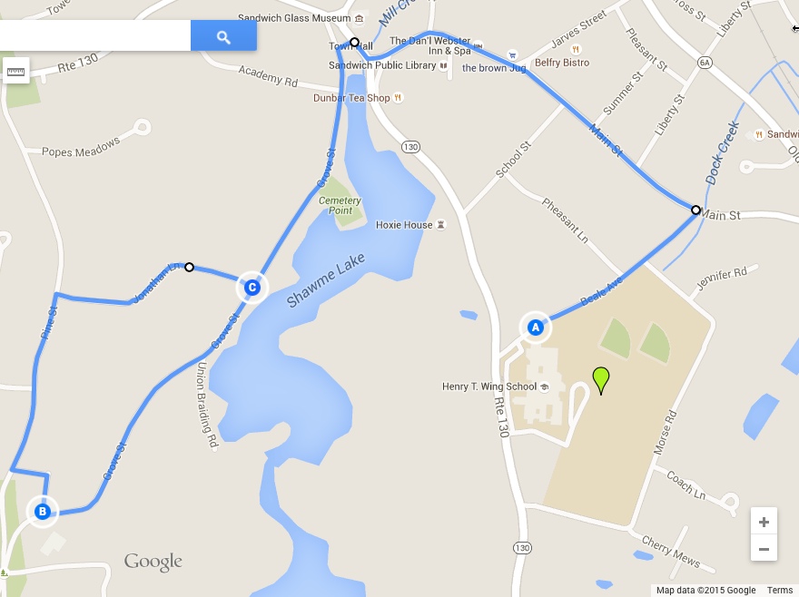
This is a 5k route or 3.1 miles long. Paved road surface throughout. Participants will gather at the front of the Henry T. Wing School (marker A), then assemble for the race start on Beale Ave, proceeding down Main Street, across Town Hall Square (at crossing with Police Officer) onto Grove Street. Cut through cemetery (marker B – water station, at 1.3 miles) onto Pine Street. Right onto Jonathan Street, left back on to Grove Street in the reverse direction, retracing route back to Wing School front lot, through the Finish Line chutes, where we first assembled.
Water available: At start/finish line; Marker B (1.3 miles)
Restrooms available: At Wing School
Parking available: BEHIND Wing School (Do NOT park in the front lot, where runners assemble).


